


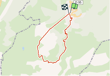

18.1 km | 34 km-effort


User


FREE GPS app for hiking
 SityTrail
IGN / Geographical institutes
SityTrail World
The world is yours!
Trail Walking of 7.2 km to be discovered at Auvergne-Rhône-Alpes, Savoy, Les Avanchers-Valmorel. This trail is proposed by zazie.
Départ depuis la station Altispace de Valmorel pour une boucle Les Voiles de Nant Les cascades PrarionD et retour Les voiles de Nant.
Mais suite à des travaux à la station Moret, la remontée est impossible. Une autre fois.
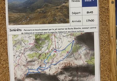
Parcours B14 / B15 / B16


Walking

Touring skiing

Touring skiing

Touring skiing

Touring skiing

Touring skiing
Walking

Walking

Walking